Research topic
With urbanization rates being at an all-time high, over 66% of the world’s population will be living in cities by 2050. In particular, the African urban population growth is dramatically disproportionate to the provision of low-income serviced housing, contributing to the persistence and growth of slums.
A “slum household”, as defined by UN-HABITAT, is lacking either durable housing, sufficient space, safe water, adequate sanitation, or security of tenure. The Sustainable Development Goal (SDG) 11, has the “proportion of urban population living in slums, informal settlements or inadequate housing” as one of its key indicators. Unfortunately, data for this indicator is often incomplete and/or inconsistent, or countries do not or under report (e.g., temporary and new settlements on the outskirts of cities). To date, the poorest of the poor are neither counted, nor mapped in most cities, even though they represent a significant part of the inhabitants – roughly 1 billion.
Area-level indicators are commonly not available for evidence-based decision support. For example, decision makers often track individual outcomes (e.g., household measurements) to gauge success and failures of decisions but require area-level indicators to set priorities, allocate resources, and plan and evaluate development projects.
Different remote sensing (RS) sources have proven their ability to map and characterize slums. On the one hand, high-resolution (HR) satellite imagery, can help highlight the general extent of slums at the city scale and have the advantage of being free of charge (e.g., Sentinel-2). On the other hand, very high resolution (VHR) satellite imagery (commercially available at a spatial resolution of up to 30 cm) allow for mapping the urban environment with higher spatial details that can be used to characterize slum areas according to their particular morphological characteristics. However, most studies aiming at mapping slums only focus on a small geographical extent, use either HR or VHR and assess only a single image analysis approach. At this time, there is no research that aims to compare the capabilities of HR and VHR and different image analysis approaches for slum mapping taking into account resource costs, performance and transferability.
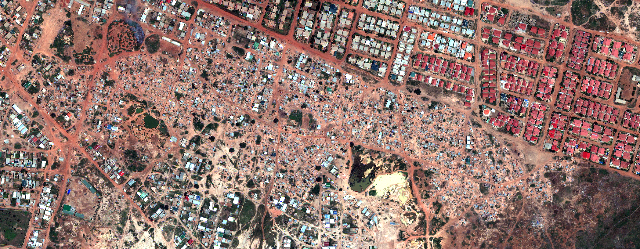
The central theme of this project is the comparison of different remote sensing data and image analysis techniques to produce geographical information on slums, i.e., their location and extent in a city as well as their morphological characteristics. Although RS data has the capability to map slums and their development over time, existing studies mainly focus on small areas, with the use of commercial VHR imagery and proprietary solutions. The latest studies using state-of-the-art classification approaches report transferability and generalizations as the key limiting factors. Therefore, to date, RS has not been used as an effective tool to provide relevant information to public authorities for resource allocation and management. To appropriately take advantage of the large amount of available RS information, accurate and scalable automated data procedures to map and characterize slums are essential.
We aim at tackling these issues by leveraging recent developments in the field of machine learning along with free and open-source software (FOSS) solutions.
A systematic semi-automated framework will be proposed to provide policy-relevant information regarding slums in sub-Saharan Africa. As a proof of concept, case studies in several SSA countries will allow for transferability analysis. Furthermore, the impact of varying the spectral and spatial resolution by implementing a multi-sensor/resolution approach, will be investigated for each case study. The ability of several HR and VHR sensors to map and characterize slums will be assessed. Moreover, for the first time, cost factors (e.g., financial resources needed) will be considered. Indeed, even if the ability of VHR imagery to map slums is obvious, their high (financial and computational) costs are important limiting factors of scalability and transferability.