Summary
PARTIMAP is an extension of SLUMAP that explored how Earth Observation (EO) and Citizen Science can be combined to better understand and measure urban deprivation in Nairobi’s informal settlements. The study tested
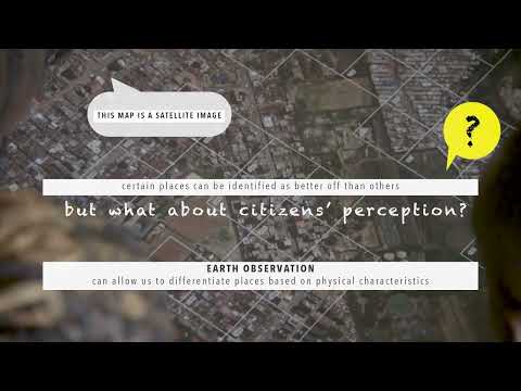
- whether satellite images—rather than ground photos—can be used in community workshops to capture how residents perceive deprivation in their neighbourhoods
- whether deep-learning modelling can be used to predict the perception of residents
How it worked
• Nearly 2,000 small urban areas (100m × 100m grids) across Nairobi’s slums were selected, and corresponding high-resolution satellite image “chips” were prepared.
• A user-friendly mobile platform allowed slum dwellers to vote between pairs of image chips, answering: “Which is the better place to live?”
• 21 workshops were held in seven different slums, involving 186 participants and resulting in over 1 million votes.
• The data were analyzed with advanced statistical methods and used to build AI models (Deep Learning and Machine Learning) that predict a deprivation perception index from satellite images.
Key findings
• Satellite imagery can reliably replace ground photos in participatory workshops, requiring only a short training session.
• Residents showed strong engagement and interest in using EO to reflect their living conditions.
• AI models can accurately predict how communities perceive deprivation. The best-performing model used only standard RGB satellite imagery, showing high predictive accuracy.
• Features most influencing the AI modelling output include street and building density, open spaces, roof colors, waste piles, and rivers—findings consistent with residents’ own views.
Innovations
• A new way to use EO imagery in citizen science with slum dwellers through an interactive online platform.
• First attempt to model social perceptions of urban deprivation with AI trained on citizen-generated data.
• Demonstrated that interpretable features of the physical environment can be quantified and linked to community perceptions.
Perspectives
Findings show that combining EO, AI, and citizen input provides valuable, scalable insights for urban planning and policymaking in low- and middle-income countries. The approach is replicable, cost-conscious, and supports progress toward SDG 11 (making cities inclusive, safe, resilient, and sustainable). Beyond deprivation mapping, these tools could also be applied to challenges such as waste management or infrastructure planning.
Watch the video